


Artist / Author / Cartographer:
Title:
Date:
Medium:
Size:
Description:
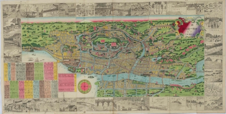
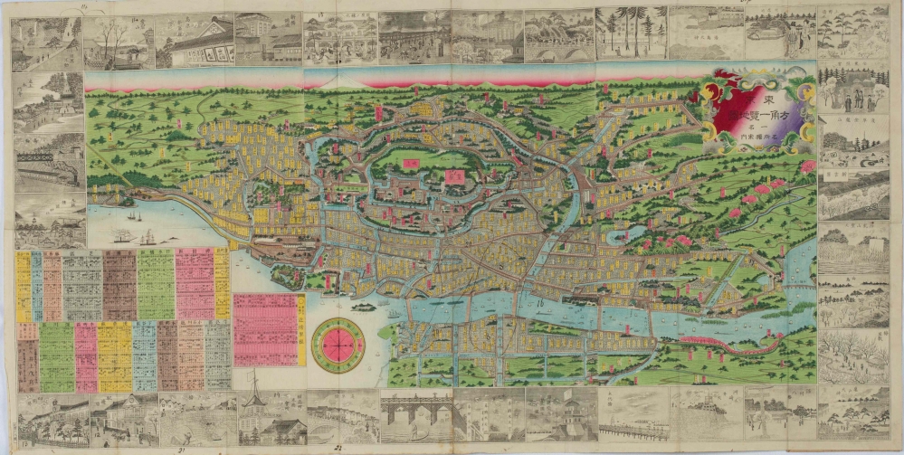
Folding colour woodblock map of Tokyo with black and white engraved images of the sites of the city around the border. Folds into paper covers 18.5 x 9.2cm, paper title label, "Map of Tokio" in late 19th century handwriting and institutional(?) registration numbers upper cover. Good copy. Meiji 13-nen. [ 1880]
Late 19th century map of Tokyo with the Imperial Palace at its centre. The map covers Kojimachi, Kanda, Nihonbashi, Kyobashi, Shiba, Azabu, Akasaka, Yotsuya, Ushiku, Koishikawa, Hongo, Asakusa and Fukagawa. The map is bordered with engraved images of 33 famous sites in Tokyo.
Condition
A few small holes at central fold, two small chips upper margin, 4 neat ink annotations at margins, a little light browning lower margin.
References:
Item Code:
attachment:
