


Artist / Author / Cartographer:
Title:
Date:
Medium:
Size:
Description:
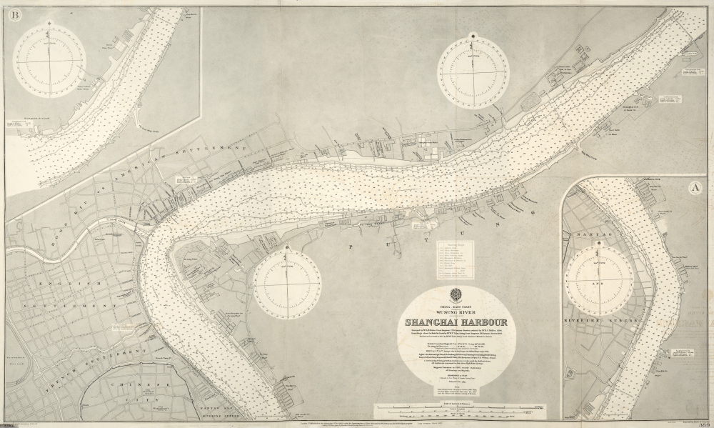
China - East Coast - Wusung River - Shanghai Harbour. Surveyed by Mr A.M. Bisbee Coast Inspector, I.M. Customs Service, assisted by Mr H.C. Muller, 1894. Re-sounded by Mr H.C. Muller, I.M. Customs Service 1906 -7.
London. Published at the Admiralty 30th November 1900, under the superintendence of Rear Admiral sir W.J.L. Wharton, KCB, FRS, Hydrographer. Large Corrections March 1903, April 1908. Small corrections 1924. Engraved by Davies & Company. Chart No. 389.
A hydrographic chart of Shanghai Harbour at the beginning of the twentieth century showing soundings in feet. A highly detailed chart showing the developing city with main buildings on either side of the river. Also the main roads are shown in the Hong Kiu or American Settlement, English settlement, and the French Settlement. Two insets show B. the extension of the river to the north and Kiangnan Arsenal and A. Nantao and Riverine Suburb.
References:
Item Code:
attachment:
