


Artist / Author / Cartographer:
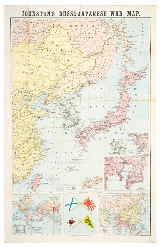
W. & A. K. Johnston
Title:
Russo-Japanese War Map. Second Edition
Date:
1904
Medium:
lithograph, printed in colour
Size:
81 x 52 cm
Description:
Drawn & lithographed by W. & A.K. Johnston Limited, Edinburgh and London.
A folding map with original red covers (10.7 x 18.6 cm), 6pp + map. Covering an area of North East China and Japan, from Sakhalin in the north to the Gulf to Formosa in the south and from Fokien Province in the west to the Kurile Islands in the east.There is an inset shows national flags. The Trans-Siberian railway is depicted.
Other insets include the world, Asia, Tokyo, Nagasaki, Seoul and Port Arthur.
References
National Library of Australia. ID 47005315
References:
Item Code:
MA8122
attachment:
