


Artist / Author / Cartographer:
Title:
Date:
Medium:
Size:
Description:
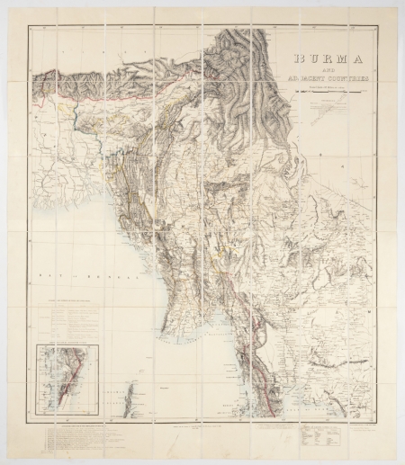
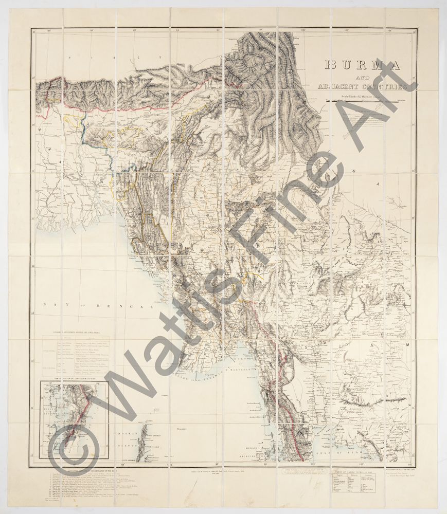
Burma and adjacent countries 1890. Scale 1 inch = 32 miles. Published under the direction of Colonel H.R. Thuillier R.E. Surveyor General of India. March 1890.
Photozincographed at the Survey of India Office, Calcutta. Price uncolored Three Rupees. Price colored Three Rupees Eight Annas.
A 48-section folding map backed on canvas. Together with original case with label, Map of Burmah, Edward Stanford, 26 & 27 Cockspur St, Charing Cross, S.W.
One of the most accurate maps of Burma for its time published by the Survey of India Office. Thibet and Bhutan appear at the top of the map, along with Bengal and Assam. Upper right the border with China is not clearly defined. The border with Northern Siam is not defined although Lower Siam is. Upper Burma is shown in some detail with Mandalay, Amarapura and Ava close together on the Irrawaddy River. Slightly further north the ruby mines near Mogok are indicated. Lower left inset details of, Divisions and Districts of Upper and Lower Burma and, Continuation of Tenasserim Division. Below the map are, Authorities consulted in the compilation of this map and Table of native terms in use.
References:
Item Code:
attachment:
