


Artist / Author / Cartographer:
Title:
Date:
Medium:
Size:
Description:
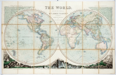
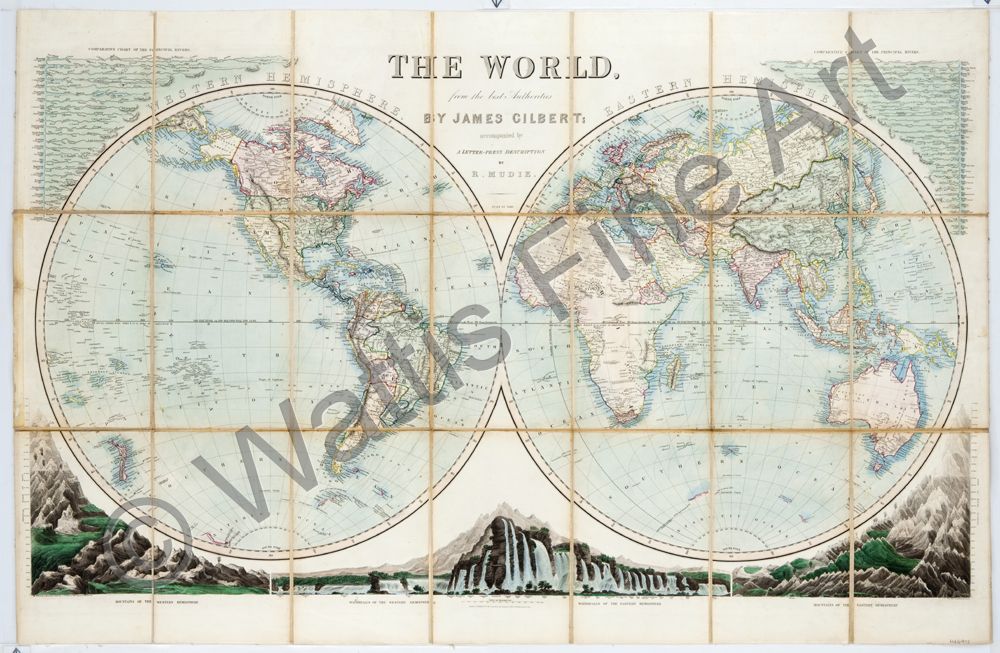
The World from the best authorities by James Gilbert. Accompanied by a letter-press description by R. Mudie. July 10 1844.
The waterfalls and mountains drawn by C.J.W. Russell and engraved by J. Archer. The map engraved by J. Lyon.
London. Published for the Proprietor by Grattan & Gilbert, 49, Paternoster Row.
A magnificent 21-section canvas backed folding chart of the World published in London in 1844. The map is surrounded by useful geographical knowledge including at the top, Comparative Charts of the Principal Rivers of the Western and Eastern Hemispheres. At the bottom, Mountains and Waterfalls of the Western and Eastern Hemispheres.
James Gilbert was an English map compiler and publisher who worked in London in the first half of the 19th century. He worked at 49 Paternoster Row. He went into partnership with Edward Grattan and together they were publishers and agents for the Ordnance Survey in the City of London.
References:
Tooleys Dictionary of Mapmakers, Revised Edition E - J Early World Press 2001.
References:
Item Code:
attachment:
