


Artist / Author / Cartographer:
Hurley, Robert Crisp
Title:
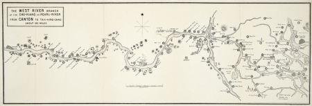
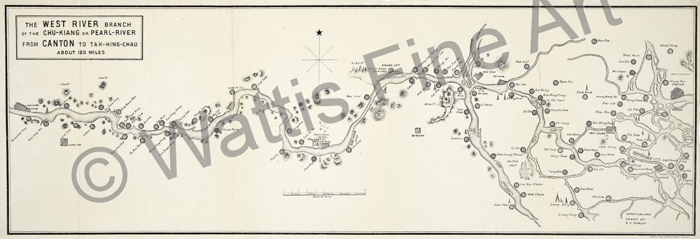
The West River branch of the Chu-Kiang or Pearl River
Date:
c1896
Medium:
lithograph
Size:
17.3 x 52.5 cm
Description:
The West River branch of the Chu-Kiang or Pearl River from Canton to Tak-Hing-Chau about 120 miles. Compiled and drawn by R. C. Hurley
Printed by HongKong Lithographic Co. Ltd.
An attractive late 19th century tourist map of the West River branch of the Chu-Kiang or Pearl River in Southern China. The map was drawn by Richard Crisp Hurley who was for a brief while the manager of the Shameen Hotel on Shameen Island, Canton.
References:
Item Code:
MA7570
attachment:
