


Artist / Author / Cartographer:
Title:
Date:
Medium:
Size:
Description:
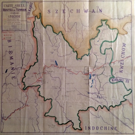
Carte Shell - Routes du Yunnan. October 1938 drawn by H. Barue & F.O. Tchao. Scale 1 : 2,000,000.
Below title is a red stamp printed with, Annexe a la note du Dece 1939. No. 1786. Printed on a waxy paper with elements of outline hand colour and pencil notations.
A fascinating and unusual map of Yunnan in south west China published by the oil company Shell in 1938. The map has been used during the Second World War with notes in pencil of place names and also dates for 1943. The red road goes from Yunnanfou (Kunming) to Mandalay in northern Burma. The Irrawaddy, Salween, Mekong and Yangtse Rivers are shown.The map was published at the time the Burma Road was being built 1937 to 1938 and elements of the red road were part of it.
Yunnan Fou was the capital city of Yunnan and became known as Kunming in the 1930s. It was the Chinese military centre during the Second World War.
A fascinating map of Yunnan Province that was used during the Second World War.
References:
Item Code:
attachment:
