


Artist / Author / Cartographer:
Title:
Date:
Medium:
Size:
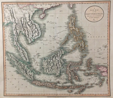
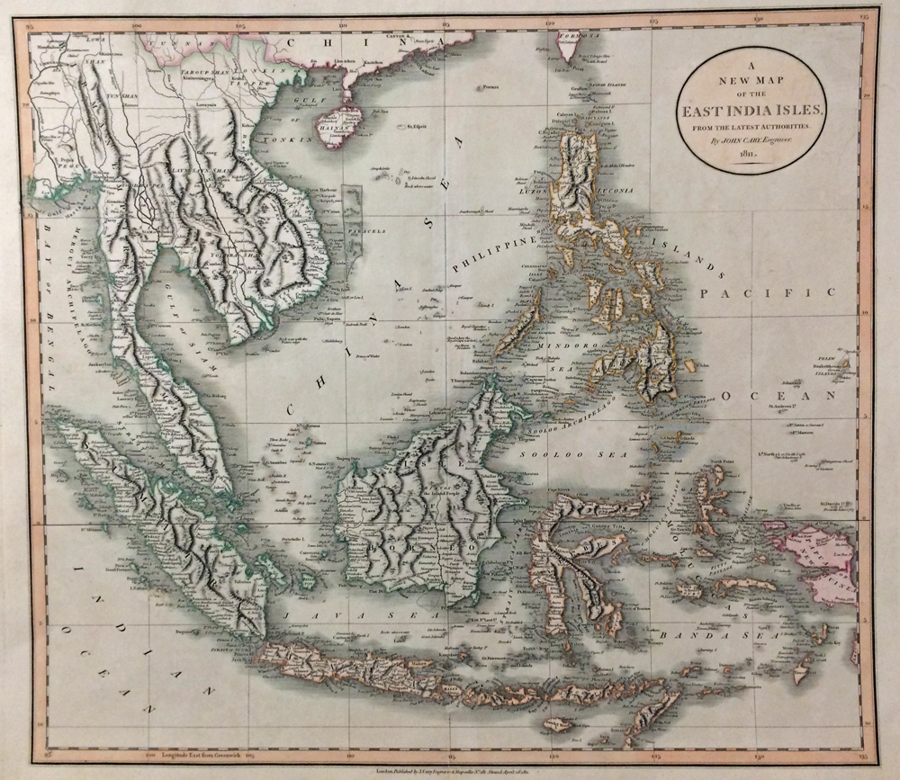
Description:
A new map of the East Indies from the latest authorities by John Cary, Engraver 1811.
An attractive map of South East Asia with bright original colour and in excellent condition. Lantao Island is depicted towards the top of the map, beside Macoa (Macau).
John Cary (1755-1835) was an English cartographer, engraver, globe maker and publisher. He had premises firstly in the Strand and then in St. James’s Street, London. In 1794 he was the surveyor of roads to the General Post Office. He was regarded as one of the finest English cartographers. He started working at a time when the large scale English County maps had recently become available, roads were being used as never before and accurate geographical information from distant countries was being received in ever increasing detail. His fine craftsmanship and ability as an engraver enabled him to make the fullest use of these sources and from them he produced a wide range of maps of great accuracy and clarity. His work covered not only county maps but world atlases, road maps, town and canal plans, sea charts and terrestrial and celestial globes.
References:
Item Code:
attachment:
