


Artist / Author / Cartographer:
Societe Toulousaine de Chromolithographie
Title:
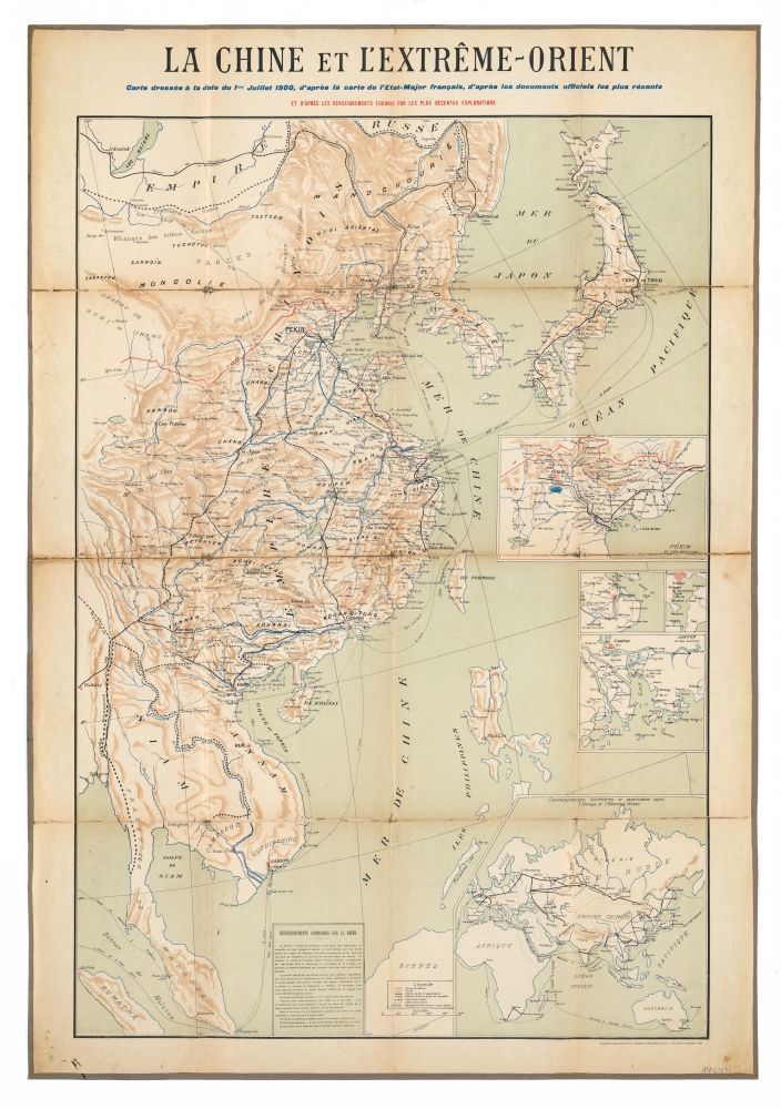
China - La Chine et L'Extreme Orient
Date:
1900
Medium:
chromolithograph
Size:
93 x 60 cm
Description:
La Chine et L'Extreme Orient. Carte dressee a la date du 1er JUillet 1900, d'apres la carte de l'Etat-Major francais, d'apres les documents officiels les plus recents. Et d'apres les renseignements fournis par les plus recentes explorations.
Published by Societe Toulousaine de Chromolithographie (Ancien etablissement CASSAN FILS)
A 16 sheet canvas backed folding map of China and East Asia. The map shows Mandarin roads, roads, established railways, projected railways, frontiers, submarine cables, routes of steam and sailing ships. to the right of the map are insets of Pekin at ses environs, Shangai, Tokio, Canton et ses environs. Also, Communications terrestres et maritimes entre l'Europe et L'Extreme-Orient.
References:
Item Code:
MA6971
attachment:
