


Artist / Author / Cartographer:
Title:
Date:
Medium:
Size:
Description:
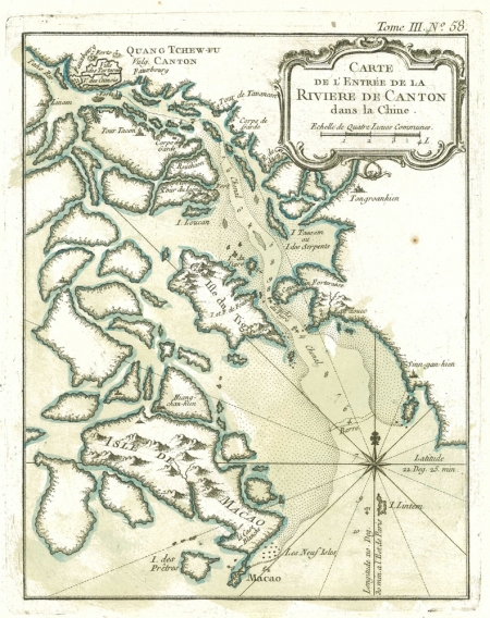
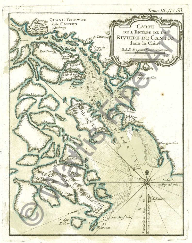
Carte de L'Entree de la Riviere de Canton dans la Chine.
A map of the Canton River published in the middle of the eighteenth century by the French mapmaker Jacques Nicolas Bellin. The map shows detail from Macao and Lintin Island (I.Lintem) to the City of Canton.Beneath the rococo cartouche the town of Tongoanhien (Dongguan) is depicted to the east of the river. Various soundings and anchorages, depicted with an anchor, are shown up the river.
The French cartographer Nicolas Bellin worked for over fifty years at the French Hydrographic Service where he was appointed the first chief hydrographic engineer of the “Depot des cartes, plans et journaux du Ministere de la Marine”. While working there he was commissioned to carry out major surveys of all the known coasts of the world. He was appointed ‘Hydrographer to the King’ and was a member of the Royal Society in London. Among the books and atlases that contained Bellin’s maps of China and South East Asia were Abbe Prevost’s Histoire Generale des Voyages 1746 and Le Neptune Francais 1753.
One of the earliest European maps to show Dongguan.
References:
Item Code:
attachment:
