


Artist / Author / Cartographer:
Title:
Date:
Medium:
Size:
Description:
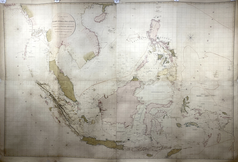
South East Asia - Chart of the East India Islands, exhibiting the several passages between their Indian and Pacific Oceans ; Inscribed to the Commanders and Officers of the British Ships navigating those seas.
Engraved by S.L. Neele. London published 20th February 1800, by A. Arrowsmith No. 10 Soho Square. Corrections to 1812.
A spectacular and rare four sheet chart of South East Asia published in Soho, London by Aaron Arrowsmith at the beginning of the nineteenth century. Produced at the time of the Napoleonic Wars in Europe when the area was of particular interest to the British as the Netherlands had been taken by the French and along with it the Dutch East Indies with its capital Batavia in Java.
The chart covers the area from the Andaman Islands in the west, to New Guinea in the east and north to Burma. Arrowsmith provides all the sea routes through the Southeast Asian archipelago to China, with detailed depth soundings, winds and known obstacles. This was the best chart of its day for the East Indianman that were sailing to the Indian ports of Bombay, Madras and Calcutta. It wasn't until the middle of the 19th century that the British Navy and in particular the Hydrographic Office would send its own ships to survey and produce updated charts of the area. The East India Company's expansion of its trade in Asia, from its base in India and later its trade with China (especially in Tea), necessitated the use of the best charts available and for this, they turned to the most imminent English mapmaker of the period, Aaron Arrowsmith.
Many of Arrowsmith’s notes of obstacles and dangers, with their ‘authority’, were sourced from Laurie and Whittle’s The Oriental navigator, or, New directions for sailing to and from the East Indies, the indispensable guide to navigation in eastern waters.
The first issue of this chart was on 20th February 1800. Later issues are found with corrections to 1809, 1812 and 1824. This is therefore the third issue of 1812.
Aaron Arrowsmith was a prominent English cartographer, engraver and Publisher. He moved to London c.1770 where he worked as a surveyor for mapmakers such as Faden and Cary. He set up his own business at Castle Street, Long Acre in 1790. He became Hydrographer to the Prince of Wales c. 1810 and to the King in 1820. He produced over 200 maps and charts. Among these were a chart of Asia 1801, A pilot from England to Canton, in seven charts, 1806, Improved Map of India (9 sheets)1816, Asia (4 sheets) 1818.
References:
Item Code:
attachment:
