Maps

Artist / Author / Cartographer:
Title:
Date:
Medium:
Size:
Description:
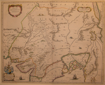
A decorative map of India published in Amsterdam in the first half of the seventeenth century. Elepahants and giraffes appear in the countryside and Dutch ships appear at sea. This map of the Mogol Empire was first published by Johannes and his younger brother Cornelis Blaeu in 1640.
In the lower left hand corner is the coat of arms of D. Johannes Hvydekoper one of the directors of the Dutch East India Company. Johannes Blaeu (c.1599 – 1673) was appointed cartographer to the V.O.C. (the Dutch East India Company) in 1638. The Blaeu family was one of the most famous publishers of maps, globes and atlases. They were also cartographers, globe and instrument makers. The family flourished in Amsterdam for more than 40 years until a fire destroyed their premises on the Gravenstraat in 1672.
References:
Item Code:
attachment:


