


Artist / Author / Cartographer:
Title:
Date:
Medium:
Size:
Description:
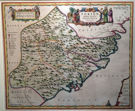
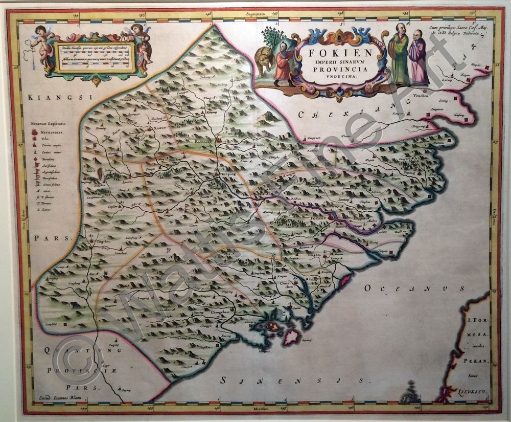
The first European published map of Fukien Province, published by Johannes Blaeu in the Jesuit Martin Martini's Atlas Sinensis, the first western atlas of China. Martini was the Jesuit in Hangchow and collated surveys of all the regions of China which he brought back to Europe in 1654 for printing and publication. Blaeu notes in his diaries: "the Reverend Father Martinus Martinius comes from India and brings with him the figurations and descriptions of the Empire of China. He insists that I print and publish these. Therefore I leave off all other things for the time being in order to push forward this work". Joan Blaeu (c.1599 - 1673) was appointed cartographer to the V.O.C. in 1638. In 1655, together with the Jesuit father Martino Martini, he published the atlas of China, Atlas Sinensis. Martini had lived in China from 1643 and had traveled into the interior of China as far as the Great Wall collecting material for a survey of the country.
References:
Item Code:
attachment:
