


Artist / Author / Cartographer:
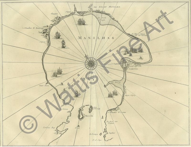
Valentyn, Francois
Title:
Manila Bay - Manilhas Bay
Date:
1724
Medium:
copper engraving
Size:
29.5 x 38 cms.
Description:
A scarce and extraordinary map of Manila Bay, showing the City of Manila, Cavite, the coastline, islands, and churches at the beginning of the eighteenth century. A compass rose appears towards the centre of the map.
Rare engraving of Manila Bay from Francois Valentyn's "Ouden Nieuw Oost Indien" published in 8 volumes in Dordrecht and Amsterdam between 1724 and 1726. Francois Valentyn {1666 - 1727} was a minister in the Dutch Reformed Church who served with the Dutch East India Company.
References:
Tooley's Dictionary of Mapmakers Revised Edition Q - Z 2004
Quirino, Carlos Philippine Cartography (1320-1899)
Item Code:
MA5078
attachment:
