Artist / Author / Cartographer:
Title:
Date:
Medium:
Size:
Description:
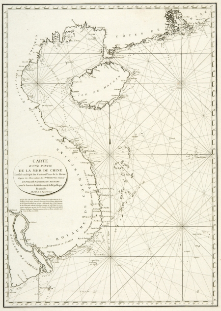
Carte d'une partie de la Mer de Chine dresse au Depot des Cartes et Plans de la Marine d'apres les Observations du Crn. Rosili Vice-Amiral et publiee par ordre du Ministre pour le service des vaisseaux de la Republique Francaise. L'An VII de la Republique.
A French hydrographic chart of the South China Sea from the end of the eighteenth century.The map is drawn showing the latest observations of the French Vice Admiral Rosili.
A chart of the northeastern part of the China Sea, with the Pearl River delta, part of the coast of southern China, Hainan, the coast of Vietnam and part of the coast of Cambodia, the Paracel islands, and other islands and reefs.
Vice-Admiral Rosili spent seven years from 1785 on hydrographic work in the Red Sea, the Indian Ocean and the seas off China
References:
Item Code:
attachment:


