Artist / Author / Cartographer:
Rees, Thomas
Title:
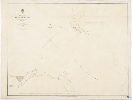
China - East Coast - Port Ta-Outze
Date:
1840
Medium:
copper engraving
Size:
46.5 x 61 cm
Description:
China - East Coast - Port Ta-Outze and the mouth of the River Ta-Hea from a sketch by Thomas Rees Commander of H.C.S Lord Amherst 1832
A note by the mouth of the River Ta-Hea states, Ning Po-Fou City 10 miles up the River. An English Factory was established there last century. Another note on an early map of the East Coast of China 1835 by Horsbugh stated Ning-Po-Foo, city of Rest or Repose, Wealthy from its great trade.
This was a hydrographic survey carried out by an officer of the East India Company.
Thomas Rees was commander of HCS Lord Amherst and surveyed Port Ta-Outze on the East China Coast. It became an Admiralty chart no. 12?? on January 10th 1840.
References:
Item Code:
MA6904
attachment:


