


Artist / Author / Cartographer:
Title:
Date:
Medium:
Size:
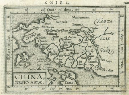
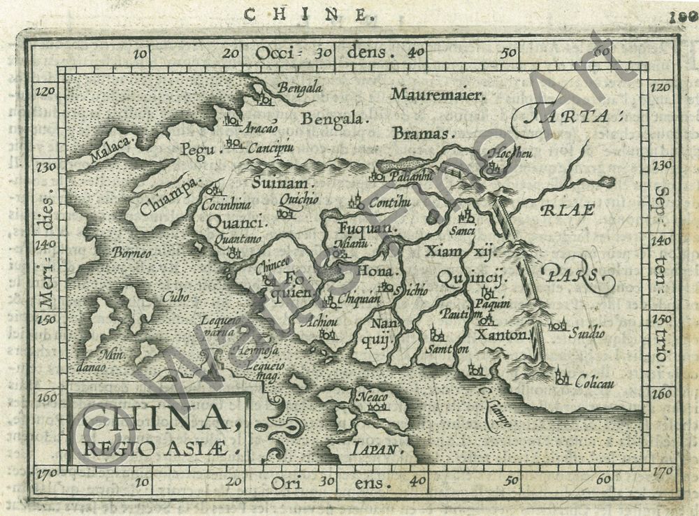
Description:
One of the most attractive early miniature maps of China. It was based on the Ortelius map of 1584 which was the first map of China to appear in a European atlas. It was engraved by the brothers Ambrose and Ferdinand Arsenius and published in 1601 at Leuven in Flanders.
In 1601 Jan Keerbergen published the edition of the world atlas of 123 maps, all engraved by Ambrose and Ferdinand Arsenius. This work, with text by Michael Coignet, was the third epitome of Abraham Ortelius' Theatrum. Between 1601 and 1612, Latin, French, English, German and Italian editions were published. The English one may have been the first world atlas in English as the date of the version published by John Norton is uncertain. The maps were copied from those in Philip Galle's final edition of 1598 but were drawn and engraved with greater care. They may be easily recognised as they have wide borders with latitude and longitude shown.
Scarce.
References
King, Geoffrey Miniature Antique Maps, Second Edition, Tooley Adams & Co., Oxon. 2003.
References:
Item Code:
attachment:
