


Artist / Author / Cartographer:
Title:
Date:
Medium:
Size:
Description:
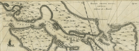
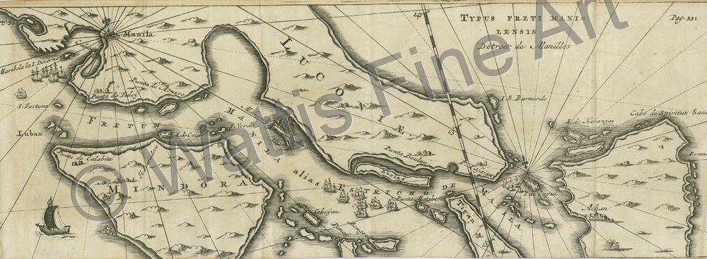
A scarce map of Southern Luzon, Mindoro and Samar Islands, showing the galleon route through the San Bernadino Channel from the Pacific Ocean and the passage to Manila.
An early eighteenth century map based on Joris Van Spilburgen's map of 1619. Joris van Spilbergen was a Dutch Admiral who circumnavigated the world in the early seventeenth century (1614 - 1617). He was one of the earliest Dutch voyagers to reach the East travelling to Ceylon and Bantam from 1601 to 1604 in an earlier voyage.
This map is from de Renneville's book, "Receuil des Voyages qui on servi a l'etablissement et aux progres de la Compangnie des Indes Orientales" ,Tome IV, p.551, published Amsterdam in 1705. This was a French translation of Isaac Commelin's earlier Dutch work of 1646. The work was an account of the early Dutch voyages of exploration around the globe with a special focus on Asia and the Far East.
The French writer Rene Augustin de Renneville was imprisoned in the Bastille 1702 - 1713. He edited and translated Commelin's work on the early voyages of the Dutch East India Company.
References:
Item Code:
attachment:
