








Artist / Author / Cartographer:
Admiralty Chart
J. & C. Walker
Title:
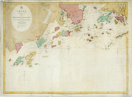
China Eastern Coast - From Mong Chow to Hong Kong
Date:
1867
Medium:
steel engraving, later colour
Size:
47 x 63.7 cm
Description:
China Eastern Coast - Sheet 1 - From Mong Chow to Hong Kong. Surveyed by Capt. Sir E. Belcher, Commr. Bate, Lieut. Gordon R.N. and Capt. D. Ross I.N.. The coast between Tyho and Cone I. by Lieut. H.C. St. John R.N. 1865.
Engraved by J. and C. Walker. Chart No. 2212
London. Published according to Act of Parliament at the Hydrographic Office of the Admiralty sept 4th 1853. Corrections Oct. 1865. Dec. 65. April 66. Augt. 67.
A detailed Admiralty chart of the south coast of China with the Pearl River Estuary. The map shows Hong Kong, Lantao and Macao with the surrounding waters and islands.
References:
Item Code:
MA6697
attachment: