


Artist / Author / Cartographer:
Title:
Date:
Medium:
Size:
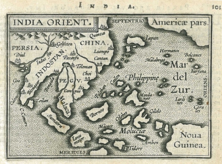
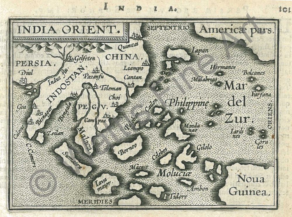
Description:
The map was drawn and engraved by Philip Galle and printed by Christophe Plantin in Antwerp.
A charming miniature map of South East Asia. In the centre of the map the Philippine (Islands) appear with Palohan, Cailon and Mindanao named. Cantan (Canton) is depicted as a large city off the south coast of China.
Latin text verso. From 1577 Philip Galle published in Antwerp a pocket version of Abraham Ortelius' folio atlas with 72 miniature maps. It proved popular and a number of maps were added from 1583 onwards. These are distinguishable from the first series by their double line borders. The 1595 edition (Ort 56) had 109 maps. India Orient is numbered 101 and has Latin text verso. Later editions were published in Antwerp, Amsterdam and London.
References
Koeman Vol III page 76 - Ort 56
King, Geoffrey L. Miniature Antique Maps, 2nd edition 2003
References:
Item Code:
attachment:
