


Artist / Author / Cartographer:
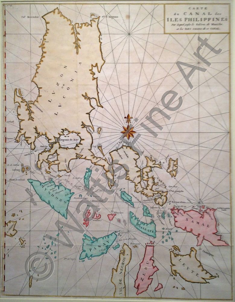
Anson, George
Title:
Carte du Canal des Iles Philippines
Date:
1748
Medium:
copper engraving, later colour
Size:
54 x 42 cm
Description:
Carte du Canal des Iles Philippines par lequel passe le galion de Manille. et les Iles voisines de ce canal.
This map was published in an account of Commodore George Anson's circumnavigation. The map shows the route of the Manila Galleon from Manila past Mindoro, Ramblon and Masbate to the San Bernadino Straits and the Embocadero out to the Pacific Ocean. Anson chased and captured Nuestra Senora de Cavadonga in 1743. He caught the ship before it reached Manila. This was the only one of 5 Manila galleons captured by the British that was carrying a cargo of Mexican silver.
Reference
Phimcos Three hundred Years of Philippine Maps 1598 - 1898. Manila 2012
References:
Item Code:
MA4557
attachment:
