







Artist / Author / Cartographer:
Title:
Date:
Medium:
Size:
Description:
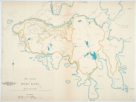
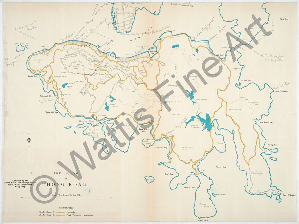
The Island of Hong Kong.
Compiled by the Crown Lands and Surveys Office, Public Works Department, Hong Kong.
Scale Two Inches To One Mile.
This unusual and charming map of the Island of Hong Kong was issued by the Hong Kong Travel Association in c1935. The map shows the recent Wanchai reclamation, which was completed in the late 1920s, the main roads around the island, minor roads, footpaths and the Peak Tramway. The names of places added in pencil include West Point, Macao Steamer Wharf, Canton Steamer Wharf, East Point, Taikoo Shipyard, Quarry Point, Lye Mun Point, Hak Tok Tau, Tai Ho Wan, Aberdeen Bay, and Repulse Bay Hotel. The back of the map contains many notes for the traveller under the headings "Suggested Excursions by Foot" and "Excursions by Water".
The Hong Kong Travel Association, “a semi-official and non-profit-making organisation [which] aims at encouraging tourist traffic both from neighbouring countries and from the world at large”, was formed in 1935 following the recommendation of the Economic Commission.
Reference: Hong Kong General Chamber of Commerce Report For The Year 1935
Wattis Fine Art A History of Hong Kong in Fifty Maps. A selection of unusual maps, charts and plans. 1775 - 1979. 2018. Map 34.
References:
Item Code:
attachment: