Warning: getimagesize(media/product/large/21011_LaRadedeSingapour1874.1.jpeg): failed to open stream: No such file or directory in /home/wattis/public_html/www/pages/product.php on line 195
Maps

Artist / Author / Cartographer:
Title:
Date:
Medium:
Size:
Description:
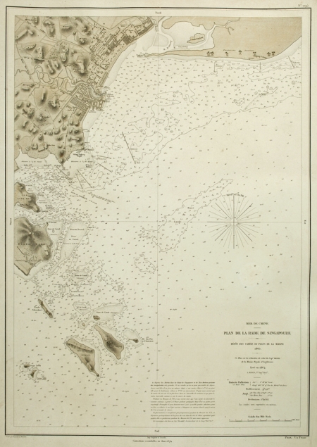
Mer de Chine - Plan de la Rade de Singapore - Depot des Cartes et Plans de la Marine 1865. Ce plan est la reduction de celui du Capt. Reed, de la Marine Royale d'Angleterre. Leve en 1864. L. Manen, Sr. Ingr. Hyd. Corrections essentielles en Janv. 1874.
Gravee par Regnieret Dourdes. Imp. Regnier et Dourdes.
A French edition of the chart of the waters around Singapore by Captain John W. Reed originally done for the British Admiralty. As commander of the sloop 'Rifleman'. Reed surveyed the seas between the British colonies of Singapore and Hong Kong, marking the reefs that were a hazard to shipping. Reed's chart was originally published in 1864. The French edition was published later the same year. This copy has corrections to January 1874.
Scarce.
References:
Item Code:
attachment:


