


Artist / Author / Cartographer:
Title:
Date:
Medium:
Size:
Description:
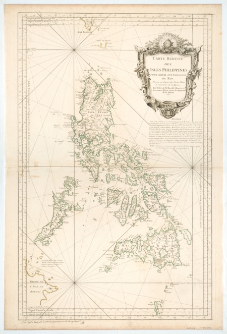
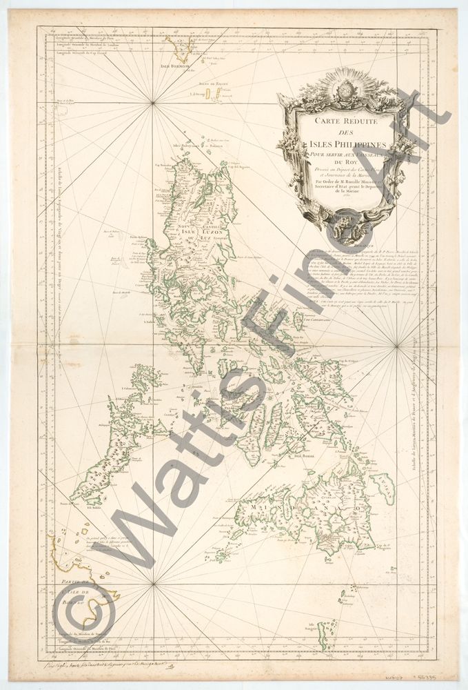
Philippines - Carte Reduite des Isles Philippines pour servir aux vaisseaux du Roy. Dressee au Depot des cartes, plans et journaux de la Marine. Par ordre de M. Rouille Ministre et Secretaire d'Etat ayant le departem. de la Marine.
Below the chart is a manuscript text in pen and ink which states, "Prix Reglé a trente sols dans tout le Royaume pour les Navigateurs". "Price fixed at 30 sous in all the kingdom for navigators". An unusual state of a magnificent two-sheet chart of the Philippines based on the original map by Father Murillo de Velarde of 1734. Pedro Murillo de Velarde was a Spanish Jesuit priest, historian and cartographer. In 1734 in Manila he produced the most accurate map of the Philippines to date, Carta Hydrographia y Chorographia de las Islas Filipinas.
The French cartographer Nicolas Bellin worked for over fifty years at the French Hydrographic Service where he was appointed the first chief hydrographic engineer of the “Depot des cartes, plans et journaux du Ministere de la Marine”. While working there he was commissioned to carry out major surveys of all the known coasts of the world. This resulted in the production of a large number of sea charts of the highest quality which appeared in many editions with varying numbers of charts. He was appointed ‘Hydrographer to the King’ and was a member of the Royal Society in London. Among the books and atlases that contained Bellin’s maps of China and South East Asia were Abbe Prevost’s Histoire Generale des Voyages 1746 and Le Neptune Francais 1753.
Framed.
Reference
Geldart, Peter Mapping the Philippine Seas. Published by PHIMCOS, the Philippine Map Collectors Society, Inc., Manila. 2017.
MA7927
HK$ 66,000
References:
Item Code:
attachment:
