


Artist / Author / Cartographer:
Captain Cook's Voyages
Title:
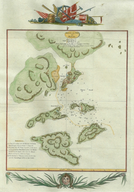
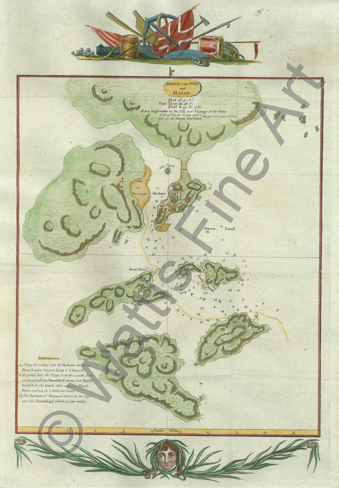
Macau - Sketch of the Typa and Macao
Date:
c.1785
Medium:
copper engraving, later colour
Size:
33.5 x 21.2 cm
Description:
A late eighteenth century map of Macau based on information acquired by the surviving entourage of Captain Cook's third voyage. This was on their homeward voyage after an epic journey through the Pacific Ocean or Great South Sea. Captain Cook's third voyage into the Pacific was when he was killed in Hawaii on February 14th 1779. On the ships Discovery and Resolution's return journey to England they called at Macau. As a result a map of Macau was published c.1784.
It is possible this map was done by Lieutenant Henry Roberts who produced many maps and charts on the voyage.
References:
Item Code:
MA7666
attachment:
