


Artist / Author / Cartographer:
Title:
Date:
Medium:
Size:
Description:
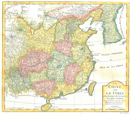
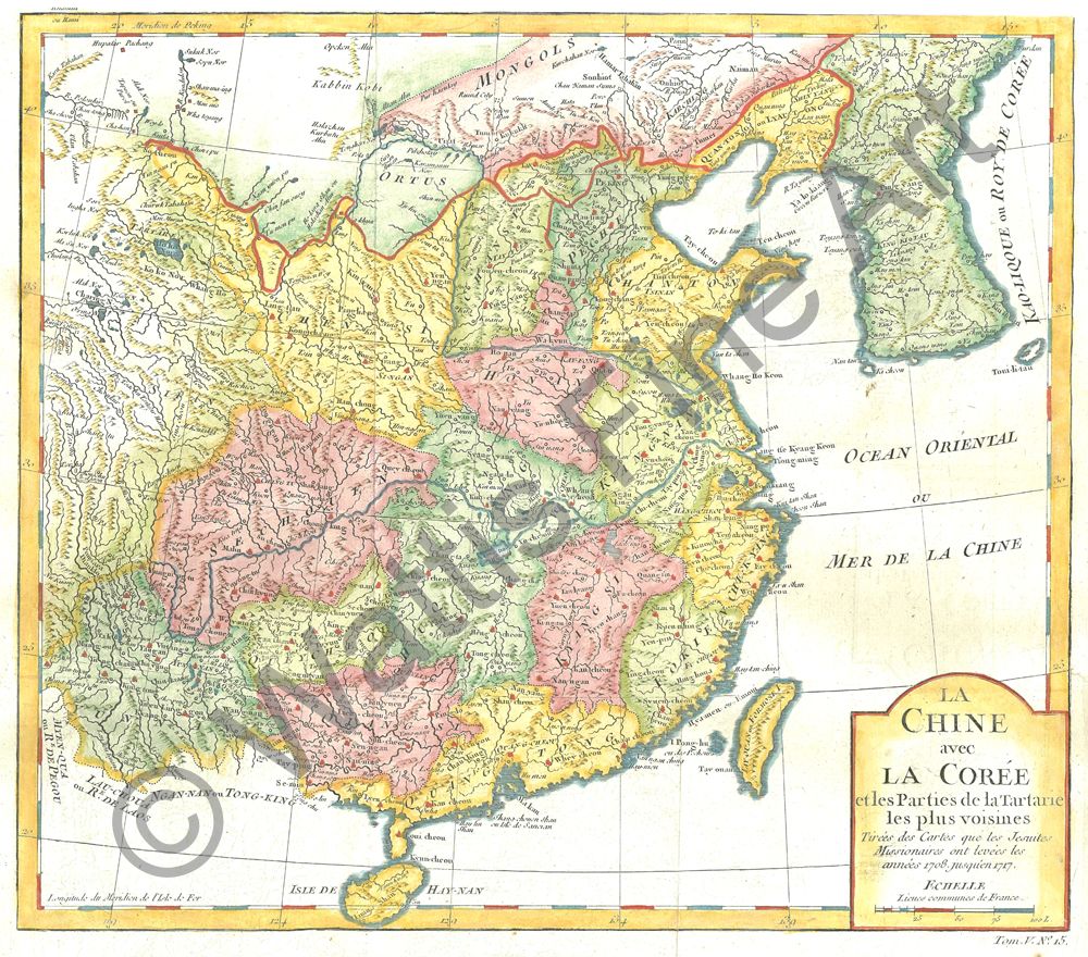
China - La Chine avec La Coree et les Parties de laTartarie les plus voisines. Tirees des cartes que les Jesuites Missionaires ont levees les annees 1708 jusque'en 1717
An attractively engraved map of China highlighting the provinces of China, based on the Jesuit surveys carried out for the Emperor between 1708 1and 1717. Quang-Chou (Canton) and Makou (Macau) are shown with the Pearl River Delta. It would be about another eighty years before Hong Kong started appearing on maps.
The French cartographer Nicolas Bellin worked for over fifty years at the French Hydrographic Service where he was appointed the first chief hydrographic engineer of the “Depot des cartes, plans et journaux du Ministere de la Marine”. While working there he was commissioned to carry out major surveys of all the known coasts of the world. This resulted in the production of a large number of sea charts of the highest quality which appeared in many editions with varying numbers of charts. He was appointed ‘Hydrographer to the King’ and was a member of the Royal Society in London. Among the books and atlases that contained Bellin’s maps of China and South East Asia were Abbe Prevost’s Histoire Generale des Voyages 1746 and Le Neptune Francais 1753.
References:
Item Code:
attachment:
