


Artist / Author / Cartographer:
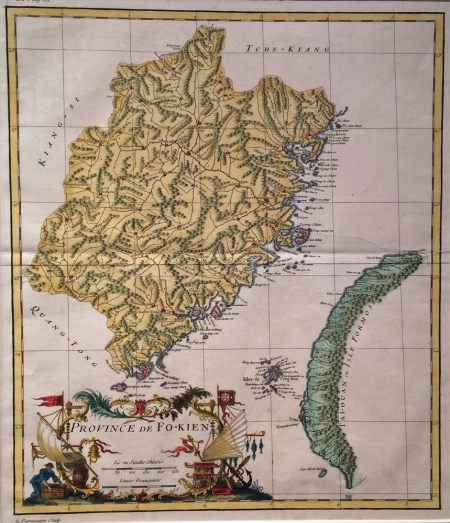
Anville, Jean Baptiste Bourguignon d'
Title:
Province of Fokien (Fujien)
Date:
1735
Medium:
copper engraving, later colour
Size:
37 x 31.5 cm
Description:
Map of the Sourthern Chinese Province of Fujien.Includes the Western coastline of Taiwan (Formosa) and the Pescadore Islands. Finely detailed. Decorative Chinoiserie cartouche. One of the earliest European printed maps of Fujien and Taiwan.
The map was published by D'Anville with the text compiled by the Jesuit Jean Baptiste Du Halde in his classic work, "Description de la Chine" published in Paris in 1735. He based his book on the manuscripts of twenty seven Jesuit missionaries. The map also appeared in the D'Anville atlas of China published in 1737.
References:
Item Code:
MA6223
attachment:
