


Artist / Author / Cartographer:
Title:
Date:
Medium:
Size:
Description:
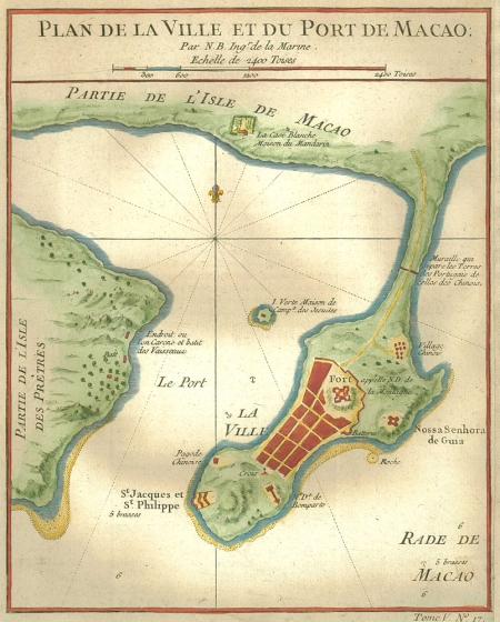
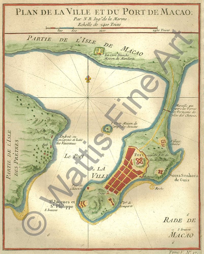
A charming mid eighteenth century map of the town and port of Macau on the South China Coast of China. The anchorage in the inner harbour is depicted with Green Island in the middle of the channel.
The French cartographer Nicolas Bellin worked for over fifty years at the French Hydrographic Service where he was appointed the first chief hydrographic engineer of the Depot des cartes, plans et journaux du Ministere de la Marine. While working there he was commissioned to carry out major surveys of all the known coasts of the world. This resulted in the production of a large number of sea charts of the highest quality which appeared in many editions with varying numbers of charts. He was appointed Hydrographer to the King and was a member of the Royal Society in London. Among the books and atlases that contained Bellins maps of China and South East Asia were Abbe Prevosts Histoire Generale des Voyages 1746 and Le Neptune Francais 1753.
References:
Item Code:
attachment:
