


Artist / Author / Cartographer:
Title:
Date:
Medium:
Size:
Description:
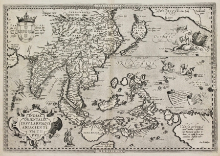
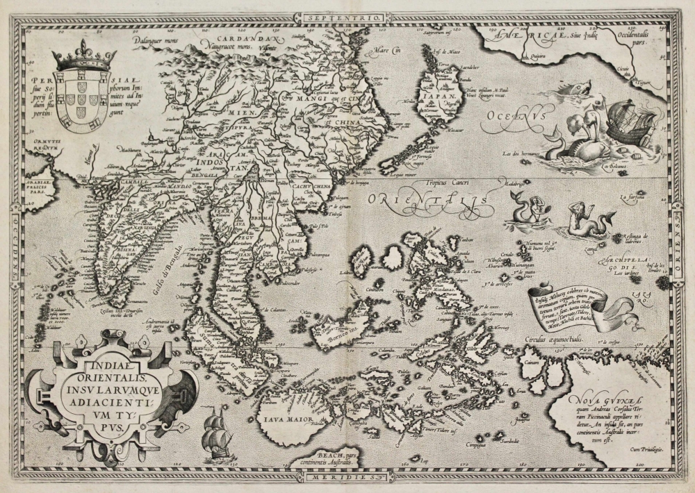
South East Asia - Indiae Orientalis Insularumque Adiacentium Typus. Antwerp, 1587.
French text verso, number 94. According to van den Broecke there were an estimated 250 copies of this map printed in 1587.
An attractive early map of South East Asia. The map shows a great leap in European knowledge of this area of the world in the second half of the sixteenth century. The coat of arms of Portugal in the upper left corner indicates the source material came from early Portuguese navigators. India, China, Japan and South East Asia are represented along with part of the north west coast of America. A large whale and sea monster are seen beside a galleon losing a sail off the coast of America. Two mermaids with mirrors appear below. alis are the first published works to definitely map Formosa and to identify it by that name (Fermosa)". The northern Philippine Island of Luzon does not appear on this map. Legaspi arrived in Manila in 1572.
The Theatrum Orbis Terrarum was Ortelius' greatest work and the first modern atlas; nothing quite like it had been attempted before. Most notably it was the first time that geographical materials had been collated and reproduced in a systematic manner. Ortelius had all the maps in his collection re-engraved in a standard size and format: many sixteenth century maps, which otherwise would have been lost, have been preserved by virtue of their inclusion in the Theatrum.
Reference
van den Broecke, Marcel P.R. Ortelius Atlas Maps, An Illustrated Guide. 1996.
References:
Item Code:
attachment:
