Artist / Author / Cartographer:
Title:
Date:
Medium:
Size:
Description:
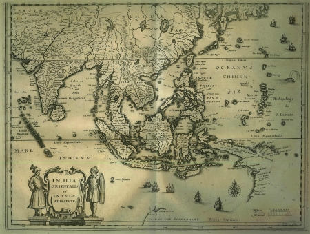
An attractive map of South East Asia based on the Blaeu Dutch East India Company map of 1635 showing the most up to date information of the region at that time.The map shows some of the early mapping of Northern Australia in the Cape of Carpentaria. To the north South Korea and Japan just appear. To the west India and Ceylon are depicted. Sincapura appears at the end of the Malacca Peninsula.
Matheus Merian was a notable Swiss engraver, born in Basle, subsequently studying in Zurich and then moving to Frankfurt where he met Theodore de Bry, whose daughter he married. In Frankfurt he spent most of his working life, and with Martin Zeiller (1589-1661), a German geographer, and later with his own son, he produced a series of topographia consisting of 21 volumes including a very large number of town plans as well as maps of most countries and a World Map - a very popular work issued in many editions. He also took over and completed the later parts and editions of the Grand Voyages and Petits Voyages originally started by de Bry in 1590.
References:
Item Code:
attachment:


