


Artist / Author / Cartographer:
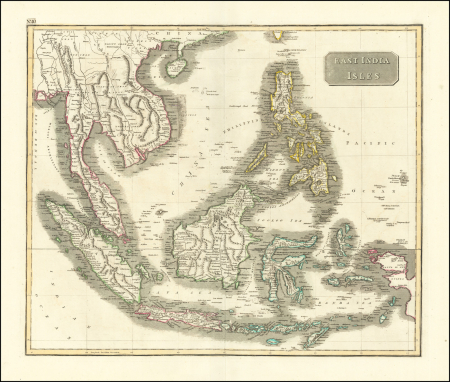
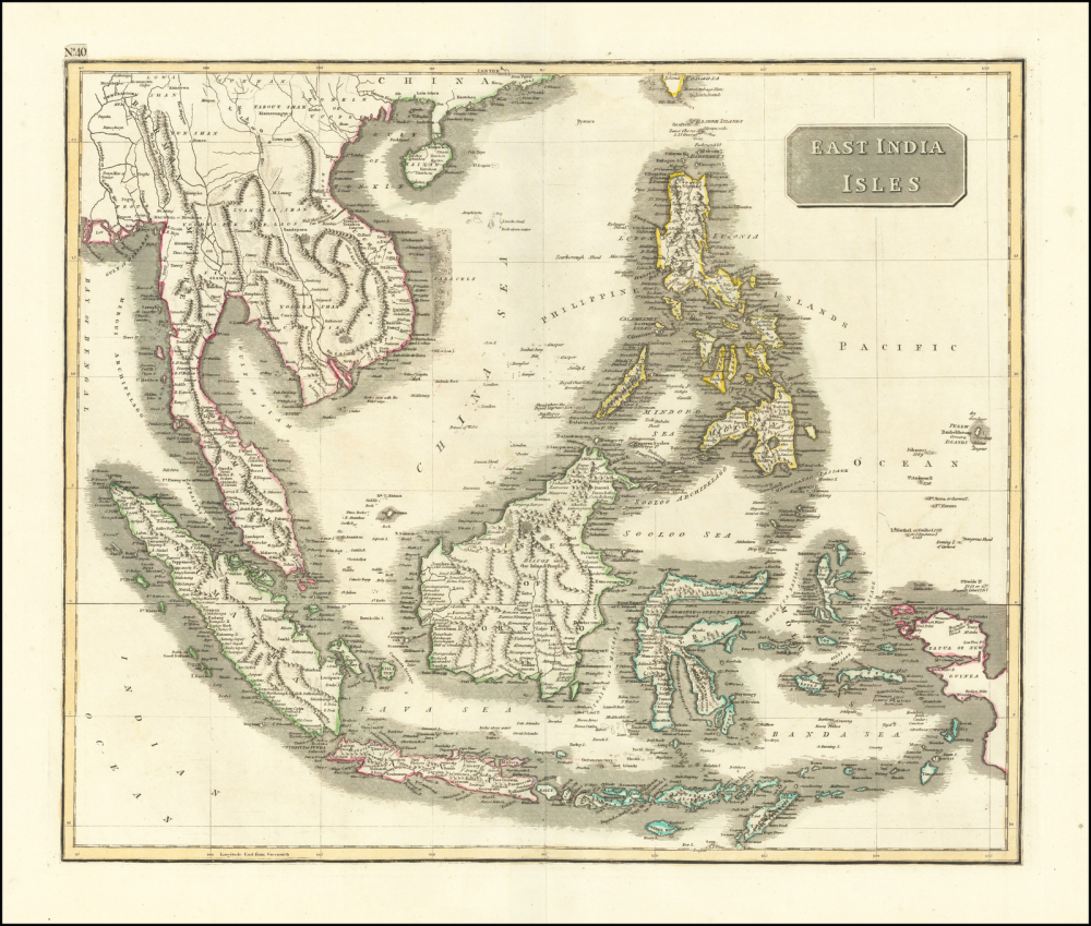
Thomson, John & Co.
Title:
East India Isles
Date:
1814
Medium:
copper engraving, original colour
Size:
49.7 x 59.5 cm
Description:
An attractive map of South East Asia published in Edinburgh at the beginning of the nineteenth century. At the top of the map South China, together with the Pearl Riva Delta featuring Canton and Macao, is shown. At the bottom of the map is Timor.
The mythical, St John's Island appears to the east of Mindanao although an accompanying note suggests "Doubtful". A little later this island would be correctly removed from the projection. Sincapoor appears as a rather elongated island.
The Scottish publishers John Thomson & Co. were working in Edinburgh from 1813 until 1869. They published a New General Atlas in 1814, 1817, 1819 and 1828. This elegant map of South East Asia was included in the atlas of 1814.
References:
Item Code:
MA8259
attachment:
