Artist / Author / Cartographer:
Title:
Date:
Medium:
Size:
Description:
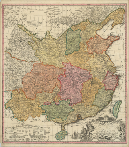
Regni Sinae Vel Sinae Propriae Mappa et Descriptio Geographica : ex mappis particularibus, quas Sinarum Rex Canghi opera patrum Missionariorum é S.I. in provincias regni universi eius rei gratia ablegatorum concinnari fecit, perfecta, Publicoque primum communicata in opere magnificentissimo R.P. du Halde et ab Anvillaeo Gall. Reg. Geographo : Cum Priv. S. Caes. Mai. nec non Reg. Mai. Pol. et Elect. Saxon
A detailed and decorative map of China drawn by Johan Matthias Haas for Homann Heirs in Nuremburg c.1740. The map is based on the surveys carried out by the Jesuits for the Emperor Kangsi in the early part of the eighteenth century and later drawn by the French mapmaker D'Anville. It first appeared in Du Halde's Histoire de La Chine in 1735.
References:
Item Code:
attachment:


