


Artist / Author / Cartographer:
Title:
Date:
Medium:
Size:
Description:
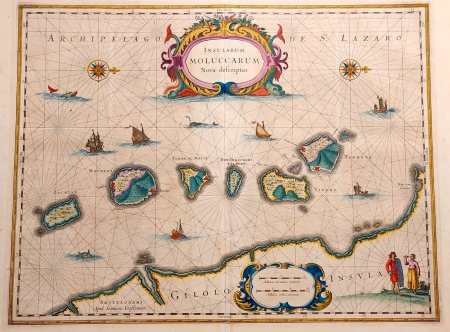
In the 1620s the Hondius family produced a loose sheet detailed map of the spice islands of the Moluccas. All five principal islands of Ternate, Tidore, Motir, Makian and Bakian are shown. After the death of Jodocus Hondius Junior in 1629 the family sold about 40 of their copper plates to the Blaeu family. Included among these was the map of the Moluccas which Blaeu changed the plates' attribution from Hondius to his own. This map was then published from about 1630 under the name of Blaeu.
To remain competitive the Hondius Jansson family reissued a handsomely engraved map of the Moluccas in 1633. Jan Jansson married the daughter of Jodocus Hondius in 1612 and he then joined the Hondius family publishing business and contributed to the updating and additions to the Mercator Hondius atlas.
References:
Item Code:
attachment:
