Artist / Author / Cartographer:
War Office, Geographical Section , General Staff
Title:
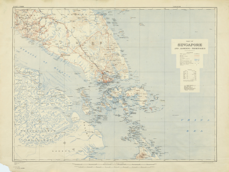
Map of Singapore and adjoining Territories
Date:
1941
Medium:
heliograph
Size:
70.5 x 90 cm
Description:
Geographical Section General Staff. No. 2981. Published at the War Office 1922. 3rd edition 1941.
Scale 1 inch to 7.9 miles. Compiled and drawn at W.O. 1922. Heliographed at O.S. and printed at W.O. 1941.
A map oof Singapore Island with southern Malaya from Malacca to Johore Bahru. Showing railways, roads, contours, heights, lighthouses etc. There is a glossary of names in Malay and English.
Also shown are the Straits of Malacca part of Sumatra and the island groups tto the south of Singapore including Pulau Batam and Pulau Bintang.
This large detailed map was published in September 1941.
References:
Item Code:
MA6261
attachment:


