Artist / Author / Cartographer:
Geographical Section, General Staff
Title:
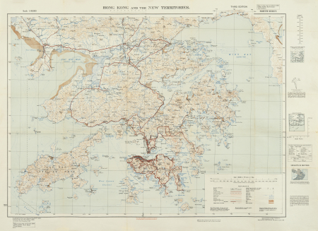
Hong Kong and New Territories
Date:
1952
Medium:
heliozincograph
Size:
64 x 98 cm
Description:
GSGS 3961 Hong Kong, North Sheet Third Edition. Scale 1:80,000 or .792 Inch to 1 Mile.
A detailed and up-to-date map reprinted by the Ordnance Survey Office in 1949 and with small corrections to 1952. The references show railways, tramways, all-weather roads, fair-weather roads, footpaths, villages, hamlets, cathedrals, churches, temples and lighthouses among other landmarks. Among various notes one reads, "The area of Chinese territory on this sheet is compiled from material of doubtful value, but is probably a fair general representation of the country. There had been little change from the 1936 edition of the same Ordnance Survey map GSGS3961. Castle Peak Bay is shown before reclamation.
References:
Item Code:
MA8861
attachment:


