


Artist / Author / Cartographer:
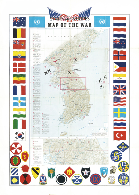
Kyoya Co., Tokyo
Title:
Korea - Pacific Stars and Stripes - Map of the War
Date:
1953
Medium:
lithograph, coloured
Size:
81 x 53.5 cm
Description:
GEOG BR G-2 HQ AFFE 19 MAR 53.
A US map of Korea from the Lorean War printed on 19th March 1953. The map shows locations of 25 actions during the war . There is also an inset map at the bottom showing key locations in what would become the border area.
The map is flanked by national flags and regimental logos below.
References:
Item Code:
MA8408
attachment:
